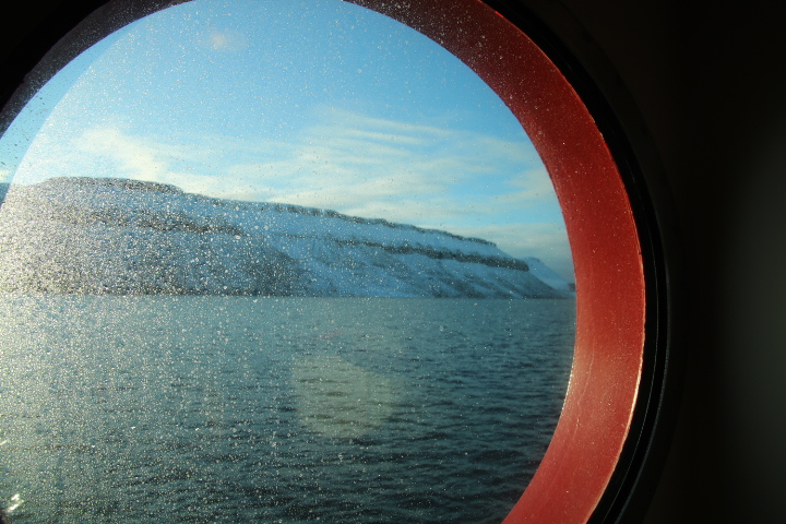
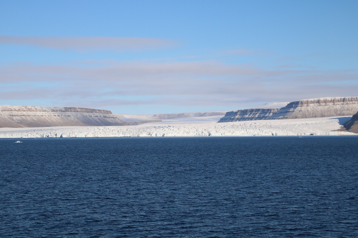
At 8:00 a.m. this morning we were sailing up Croker Bay, on the south of Devon Island, to where one very big and two smaller glaciers reach the sea. We are at 74° 07´ North, 83° 02´ West.

Croker was the First Secretary of the Admiralty when his name was used by John Ross on his first expedition to find the Northwest Passage in 1818. (More about that later.) Ross sailed west along Lancaster Sound in between Devon and Baffin Islands just as we have done and may have taken shelter in this bay. It is thought that the bay was named by Parry on his 1819 expedition. As Ross’s expedition was an Admiralty funded one, it was as he ventured west in Lancaster Sound something mysterious happened and no one really knows the reason for this. Legend has it that near here Ross was surrounded by sea fog which forced him to slow down and even stop in the Sound. As the fog parted he suddenly reported seeing a mountain range ahead of the ship blocking the Sound. He stopped and without any consultation, turned around and went home. He called the mountains of this ‘mirage’ the Croker Mountains. He was no longer in favour with the Admiralty and still today it is a mystery what he actually saw.
William Parry was invited by the Admiralty to lead the next expedition, despite bitter debate between the three parties over Ross’s decision. In 1819-20 Parry had luck with the ice and managed to negotiate it to Melville Island and what is today Parry Inlet where the ice eventually stopped him. He was almost through the Passage.
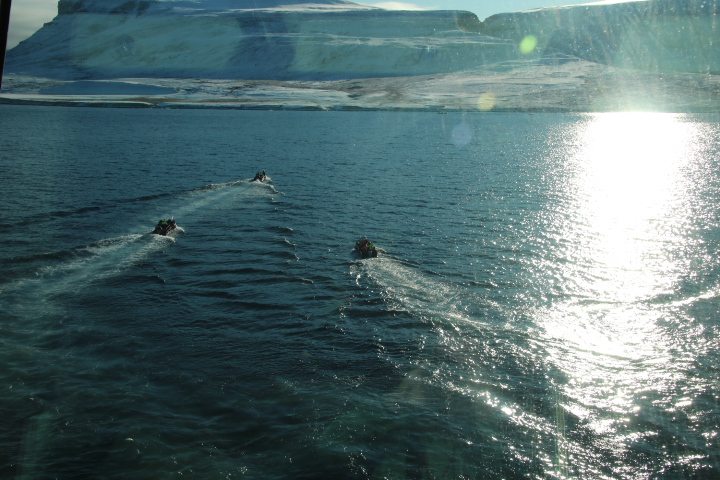
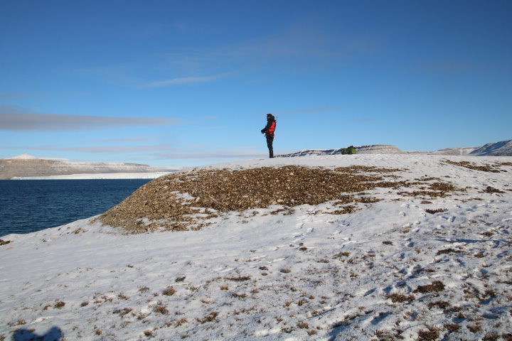
Around 10:0 a.m. the expedition leaders went ashore to establish the landing zone, define the limits of our explorations and post polar bear watchers.
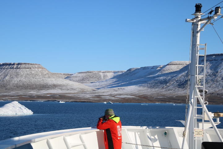
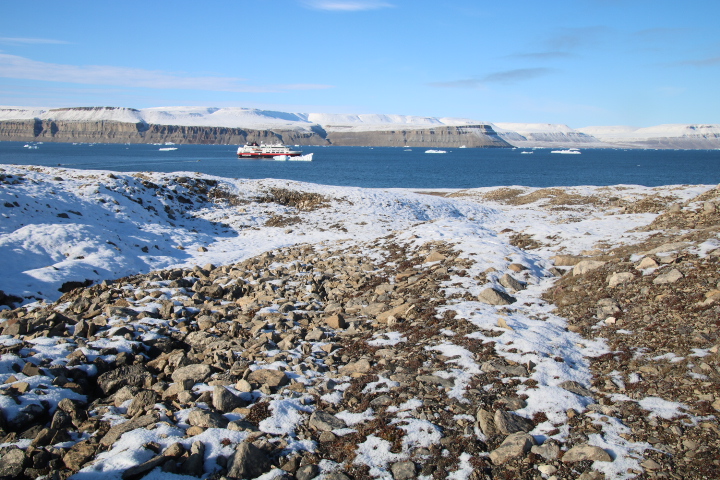
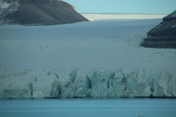
We are moored at the head of Croker Bay and are about to explore part of the eastern shoreline. We are surrounded by mountains and cliffs of sedimentary rocks in perfect layers and untouched by any earth movements or fracturing.


We landed on the strand-flat which is the elevated moraine acting as a beach on the edges of the fjord. We were greeted by an Inuit Leader from Cambridge Bay dressed in traditional clothing which was handmade by her. Nearby were recent polar bear footprints that were certainly not size 41! We walked uphill across frozen peat bog and tundra to reach the first moraine. This moraine was at the centre of the glacier further up the ice but resistant rocks split the glacier and resulted in this moraine being at the edge. These rocks now on the ground were originally part of the mountains and plucked from the sides and carried by the ice on its surface. Near here was a drumlin with small fragments which were carried beneath the ice but not carried very far as most of them were angular and not rounded. The ice has had at least two attempts at shaping this landscape. The first before the last Ice Age (about 1 million to 10,000 years ago) filled the existing river valleys changing them to the classic U-shape of glaciated regions, but this ice was not as high/deep as the landscape and so one can identify a level groove across this area where the top of the first ice was. With climate change that first ice melted and that meltwater has carved more grooves in the landscape. The biggest change came during the Ice Age when this region, vast areas of North America and Asia as well as Europe were covered by ice that filled and overflowed the existing glaciated valleys. This shuffling of the ice eroded the tops of the mountains and created summits all of the same height. These are known as concordant summits and the sections of the mountains nearest the fjord that stand up above the summits stood proud of the ice and therefore were not eroded. These are known as Nunataks. Further back in the landscape are mountains which were untouched by the Ice Age but are eroded by today’s ice and the constant frost action where changes of temperature shatter the rocks.


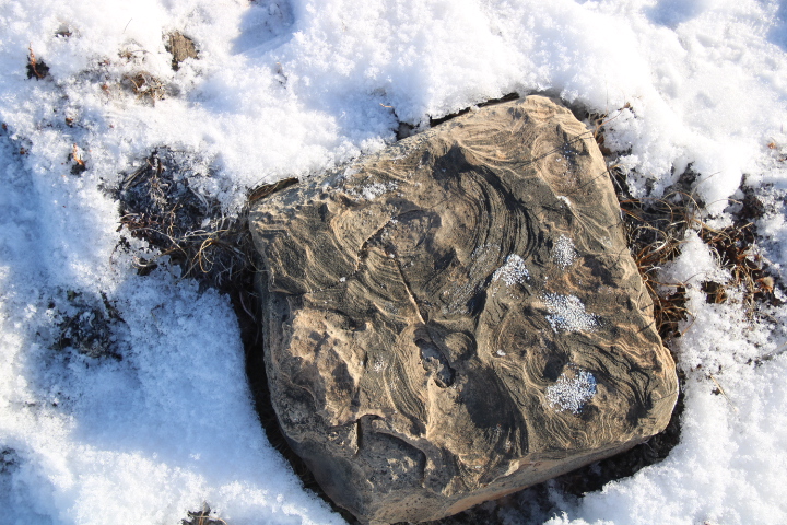


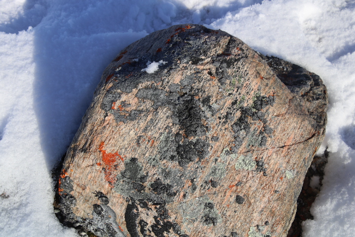
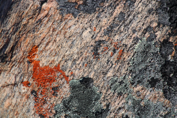
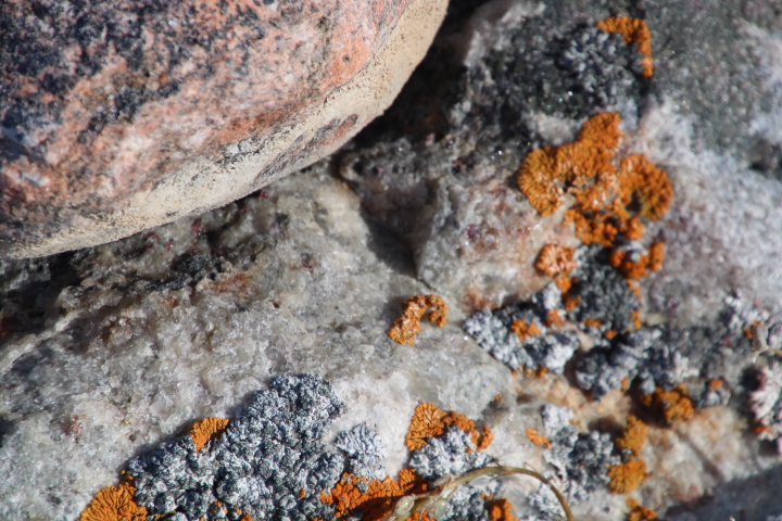
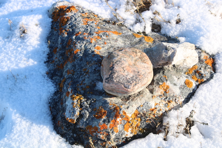
The rocks strewn about the landscape are millions of years old and were formed mostly in shallow sub-tropical seas and even deserts. This indicates that either this region was affected by massive climate change, or more likely, the volcanic base rock which is some of the oldest on earth was part of the first primeval continent Pangea and with continental drift has arrived in this part of the world. The rocks on the surface show evidence of frost action which splits the rocks, evidence of striation as rocks carried by the glacier scratched against other rocks as well as containing fossils such as ripples in sandy beaches and fossilised tree bark. Possibly the most exciting find is shown in the next series of photographs. It is an angular fragment of volcanic base rock which has been plucked from the bottom of the mountains and because of its weight has not moved very far but on top of it is a rounded piece of base rock that has been moved around by the ice on the boulder and created a kettle hole-like shape in the rock. This is very, very old and we may be the first people to witness this as few people come here. The mountain wall shows evidence of erosion by water, most likely snow melt. There are alluvial fans and scree slopes at the base.


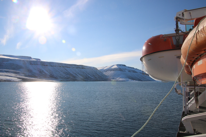
On transfer to the ship we saw two sizeable bergs relatively close to the Fram and when closer identified our cabin by the aluminium flask visible in the window.


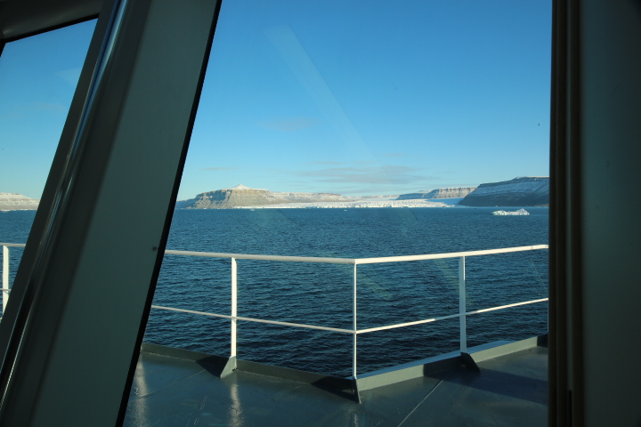
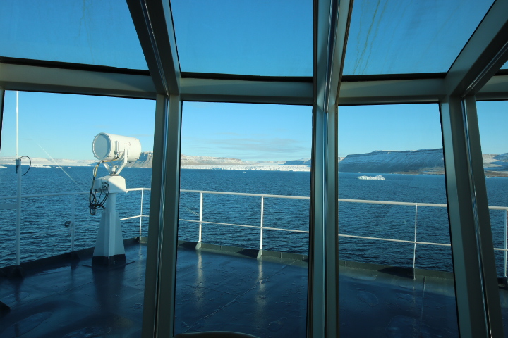
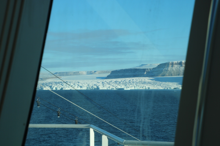
This afternoon we cruised the head of Croker Bay on the Fram. We passed glaciers and icebergs that have been here for a very long time and witnessed smaller bergs drifting out to sea. We passed the snouts of three glaciers but we were always surrounded by the high sedimentary cliffs. This took several hours which gives an indication of the size of this inlet which is only one of many which receives the ice from the centre of Devon Island.

By 19:30 we had reentered the Lancaster Sound and encountered sea ice. Sea ice is different from glacial ice because it is essentially the frozen sea. Sea water freezes between 1° and 2°C and with below zero temperatures in the air can lead to a mass of hard and immovable ice blocking the route. As we write this doesn’t look like it will happen but in the distance it is difficult to tell because as the last photograph will show there maybe ice across the Sound.


STOP PRESS! We have just been informed that we are going to sit out the night in the eastern side of Lancaster Sound in an ice free area and wait for first light before moving on.