At 77N and 15E we awoke in Horn Sound and the former settlement of Burgerbukta claimed by travellers as one of the most spectacular scenic areas of the west coast of the archipelago. We arrive on a flat sea and surrounded by fog which by the end of breakfast was lifting.
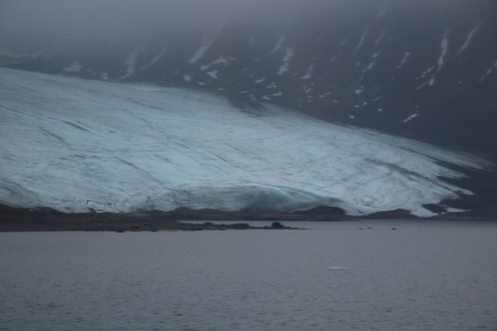

From the cabin in this rather foreboding, grey, early morning light we were beginning to sea the far east of the fjord surrounded by glaciers.


To our right the Hornsundtud Mountain at 1431m rises straight from the fjord.


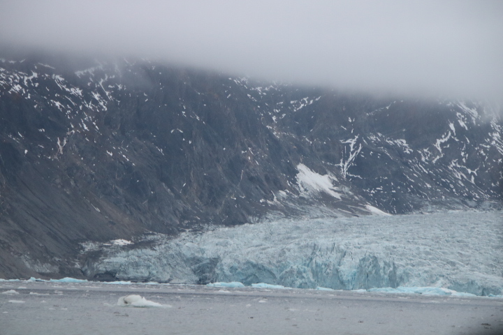
Horn Sound may be derived from the English name which indicates a through passage which is today blocked by ice. We think it is a possible reference to the ‘Cape Horn’ at the southern tip of South America which is separated from the mainland by a Sound. The growth of the glaciers in the Little Ice Age is likely to have blocked the Sound. Early visitors would have been able to navigate the whole of the Sound and Dutch captains possibly from Hoorn in the Netherlands gave the name to this area.
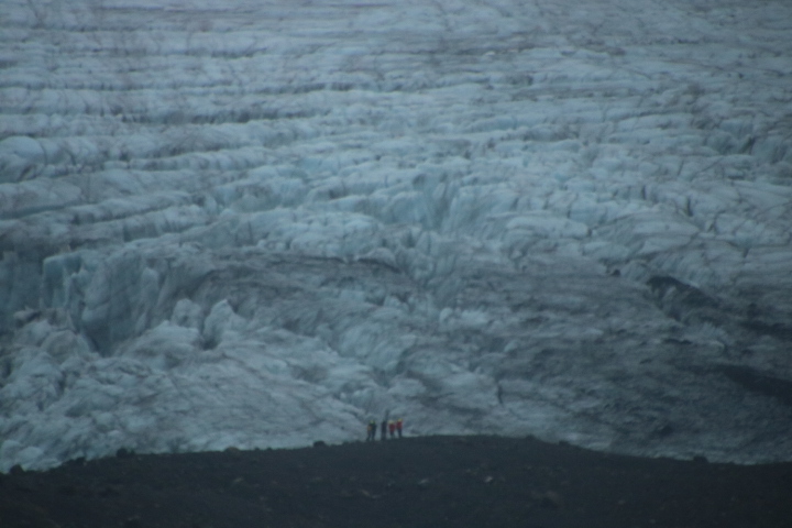
The moraines which we crossed are a mixture of sub-glacial (round) and surface glacial (edged) which are evidence of the amazing erosive forces at such low speeds.
Burgerbukta and to the east Hamburgbukta were whaling stations. The Dutch were the first here but as the names imply the Germans and Norwegians followed (Bergen and Hamburg). In the far north of Spitsbergen is Smeerenburg (Blubber Town) founded in 1619 at the Dutch settlement of Amstedamoyen.
We slipped out of Hornfjord with increasing fog as we approached the open ocean. We passed the ancient, now uplifted, landscape known as the peneplain which was here before the Ice Age and would have been the ‘backscene’ of sluggish rivers, muddy plains, small forests inhabited by deer, foxes and birds.


During the late afternoon we passed a sea eroded limestone pavement as well as more glaciers and fields of sea ice. We are now heading south towards Bear Island.