We arrived at Panama at 6;15 a.m. and from the cabin window we could see illuminated ships waiting to go through the Atlantic entrance which is a breakwater at Colon which protects anchored ships from the northerly winds. Spoil from the canal was used to make this.
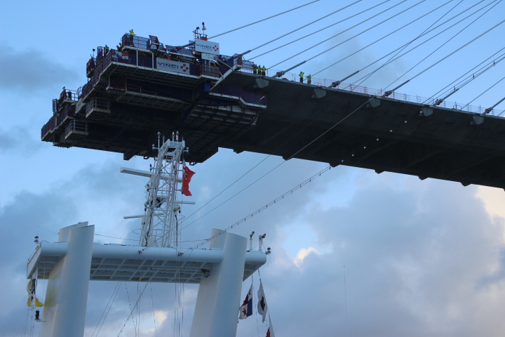
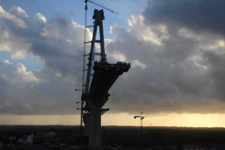
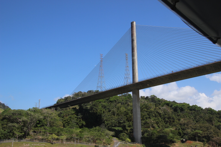
Panama is the shape of a letter S, which means the northern coast is washed by the Caribbean and the southern coast by the Pacific. This angle is confusing because when one enters the Panama from the Atlantic Ocean the sun naturally rises in the east but is viewed over the Pacific. At this time we crossed under a bridge under construction to the cheers and waves of construction workers on the road deck.
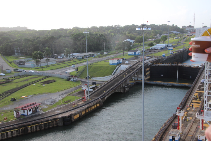
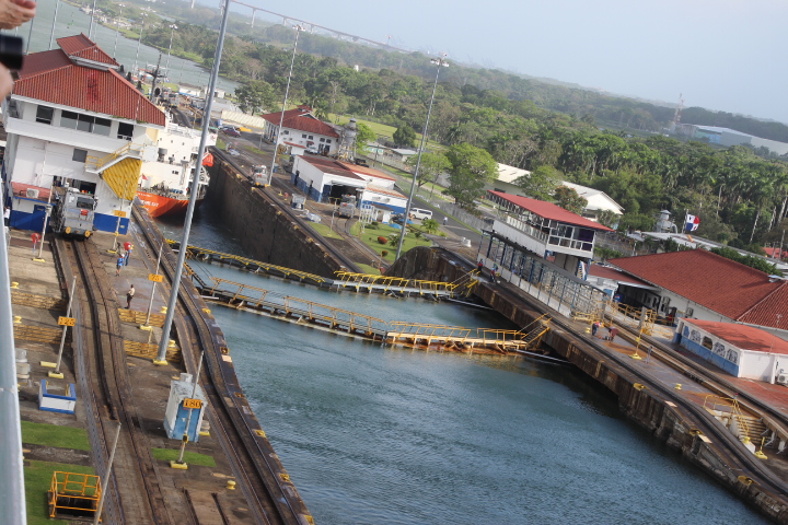
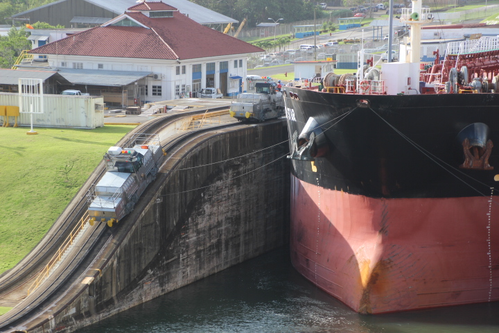
We picked up a pilot or three here and at our time made our way to the Gatun Locks. By now it was 8:00 a.m. The locks are the longest of the canal and in our case in three steps lift the ship 26 metres in an hour. It takes skilful navigation to fit the ship in each of the lock chambers with only centimetres to spare on each side. Like any canal system there is a chance that water can be lost in moving ships up and down, but in the Panama’s case the water is saved and reused through an ingenious series of chambers that move the water from lock to lock. Locomotives called mules are attached to each ship by cables and maintain the ships position in the lock as the ships moves forward. It takes between 4 and 8 mules to guide ships through each lock.
The Panama Canal is cut through the dense tropical rainforest of the Isthmus of Panama. (A slender section of rock, sand and mud that in this case was created by earth movements that made the Atlantic and Pacific from the one primeval ocean.) Thousands of workers lost their lives in its construction from accidents but mostly diseases such as malaria and yellow fever. Following the successful opening of the Suez Canal in 1869 it was decided by a Congress of Paris in 1879 that a canal across the isthmus should be built. In 1880 construction started led by Ferdinand de Lessops of Suez Canal fame. It was such a massive construction project that 18,000 Caribbean islanders were involved in just one location. It was such an ambitious project that French engineers (Gustav Eiffel and others) were assigned parts of the project to oversee and complete. Between 1882 and 1903 60 million cubic metres of earth and rock were removed.
Panama was originally part of Colombia but when independent the Panamanians and the French needed a new partner with the long running construction project. President Theodore Roosevelt (USA) saw the potential of the project and the following investment led to its completion in 1914. Since 1999 it has belonged to Panama following an agreement by President J Carter in 1977 to hand over the canal and collect the fees for the transit. It is such an important sea route that a new series of wider and longer locks parallel the original ones to allow the world’s biggest ships to cross the Oceanic Divide. A couple of examples: the distance from New York to Sydney via Cape Horn is 20,712km but via the Panama Canal is 16,013km. The distance from New York to Japan via Cape Horn is 26,892km but via Panama is 16,448km.
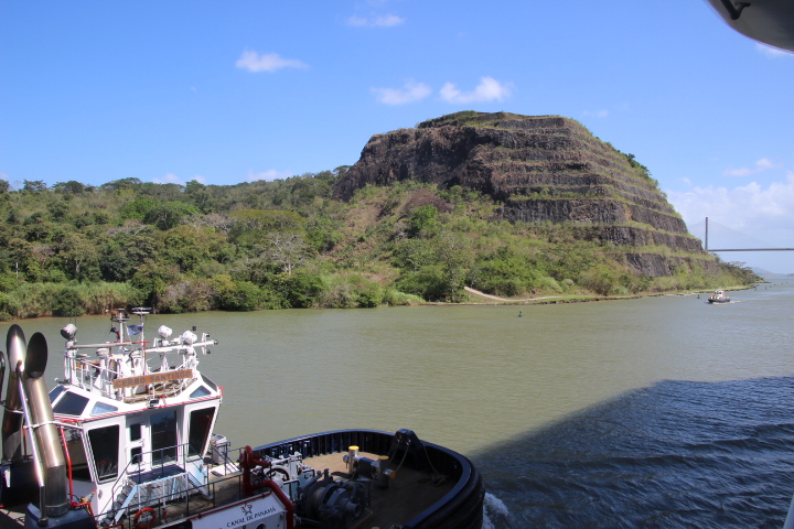
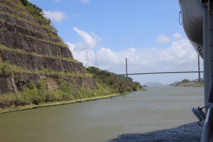
Our journey from the Gatun Locks proceed across the Gatun Lake. This was made by building the Gatun Dam across the natural Chagres Valley which dammed the river water and made, at the time, the world’s largest artificial lake. As the waters were held back by the dam vast areas of rainforest were flooded. Today only the highest parts stand proud of the water as islands many of which are wildlife refuges. By now temperatures are in the high 30sC and it is time for lunch before we reach the Gaillard Cut and the site of the Culebra Slide. This nearly 14km section of the canal is a narrow, winding passage with steep sides that cuts through the Continental Divide. This line follows the watershed of all rivers that flow into the Atlantic or Pacific Oceans and stretches from Alaska (USA) through Canada, the USA (lower 48), Mexico and Central America.
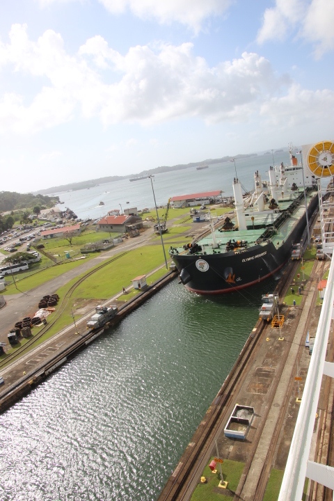
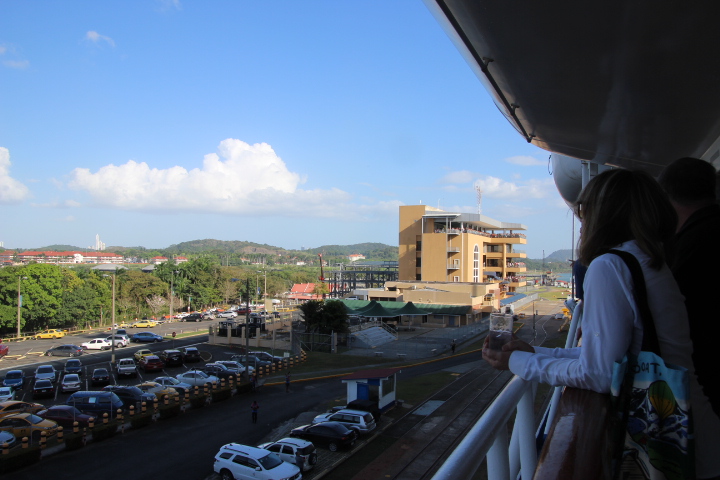
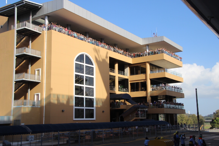
We passed beneath the Centennial Bridge and entered the Pedro Miguel Lock which dropped our ship 9.5m to the Miraflores Lake before entering the ‘last drop’ to the Pacific Ocean. These duel locks lowered our ship 16.5m in two steps in just over the length of 1.5km. Here is a Visitors Centre, which on the day of our transit was packed with people on the Observation Decks witnessing the action on what has been described as the ‘eighth wonder of the world’.
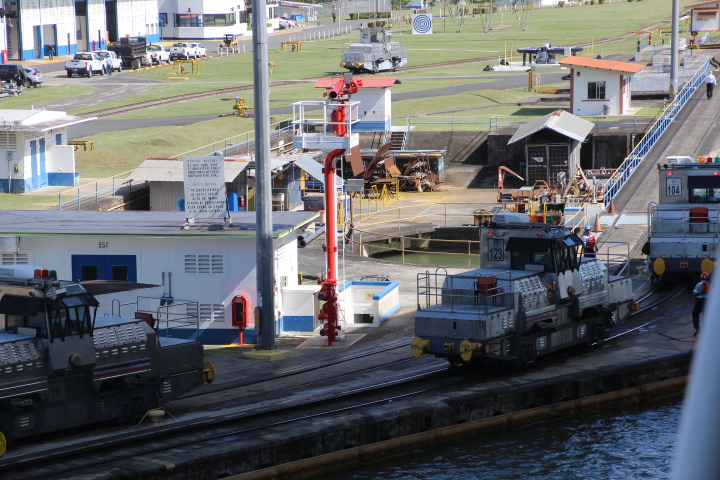
The Miraflores Locks having dropped 16.5m from our cabin on Deck 5. These show early 20th century concrete and the steel lock gates, the last before the Pacific Ocean.
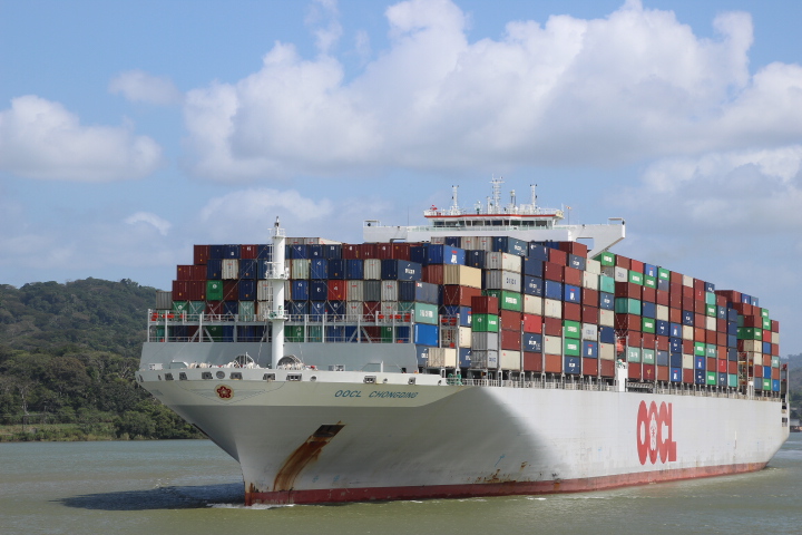
Opened in 2016 the new locks can accommodate ships many times bigger than the freighter ‘Ancon’ which made the first crossing of the ‘big ditch’. Despite the investment in the new locks one type of ship known as the Triple-E ship is much larger than the new locks. It uses less fuel, has a smaller CO2 footprint and uses fewer crew members but will only sail from Asia to Europe as part of a water based Silk Route.
We continued to the Fort Amador cruise port at Panama City. This is at the end of a causeway that has been developed as a tourist area of beaches, hotels and shops which started its life as a breakwater to protect ships just like the one at Colon.